H.A. Buckley and the Route 66 Owners Association
by Rhys Martin
US Highway 66 was re-aligned many times during its life. There were many reasons that such realignments occurred: safety, land acquisition, changing geographical conditions. In Oklahoma County, a re-alignment in the latter years of Route 66’s official designation would inspire a group of landowners to sell off pieces of the famous highway as a preservation tactic. But did that actually work?
Back in 2020, the Oklahoma Route 66 Association received a message from a person asking about a section of Historic Route 66 that they claimed they had ownership of. They explained that they'd purchased a stake in the road back in 2002 and they were looking for some updated information. I'd never heard of such a thing and checked with our Executive Director at the time.
It turned out that our Association did get an occasional call about this, but it was pretty rare and details were scarce. Nobody seemed to know much beyond the broad strokes: someone in the vicinity of Luther, Oklahoma had sold small parcels of property that included an old alignment of Route 66. I couldn't find much more information back then...but a separate inquiry came in 2023, this time with copies of some paperwork. That gave me enough information to do some digging and come up with more information.
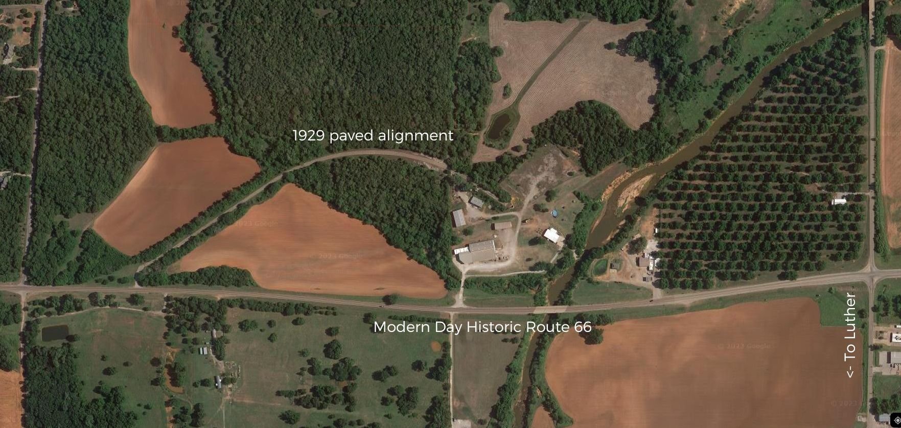
Google Maps view of the original curved alignment, with modern day Historic Route 66 below it.
Highway 66 on the north side of Luther was paved in 1929, just three years after it was formally established. It included several bridges, notably over the Frisco and Katy railroad lines. In 1979, the State of Oklahoma realigned the highway (it had become State Highway 66 by then) to straighten it out. By that time, the Katy Railroad was gone and the landscape had changed somewhat. The original road, however, was left in place and was deeded back to the original landowners. The ribbon of concrete, which had carried Route 66 for fifty years, was now private property.
In 2001, a real estate broker named Henry Allen “Pat” Buckley formed a group called the Oklahoma Route 66 Owners Association. Henry co-owned 160 acres of land that contained that original paved alignment and formed the association to sell off the land, one square acre at a time, to ensure its preservation. “You’d have to have the permission of all of those thousand people in order to sell it,” he told the Daily Oklahoman. “That Route 66 will be there forever.” Pat stated that the money raised would be used to maintain the property, and of course profit the landowners. “I’d like to think it will be a money-making proposition,” he continued. “I’m not sure if it will be or not. The main thing is the preservation of it.”

An article that ran in several newspapers in Oklahoma in late 2001 that talked about the preservation effort.
Each square acre was sold for $49.95. Owners received several things in the mail, including a warranty deed, a membership certificate, a copy of the original press release, and a map.
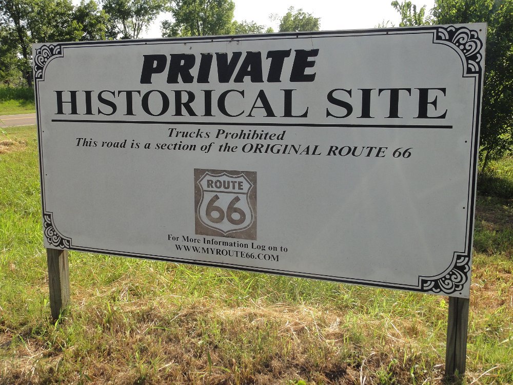
Signage that once stood at the entrance of the private paved section of road. It is now fenced off.
After that initial announcement, information becomes scarce. A website for the organization was active through 2015, though it went through several changes over the years. The cost of a deed went up to $66 in 2004 and the person responsible organization changed to Dale Allen Liles of Bethany. In 2014, the site changed entirely as a landing page for Buckley’s Private Detective Agency, though it did still reference its original Route 66 preservation purpose. Dale Liles passed away in 2013 and Henry Buckley passed away in October 2018.

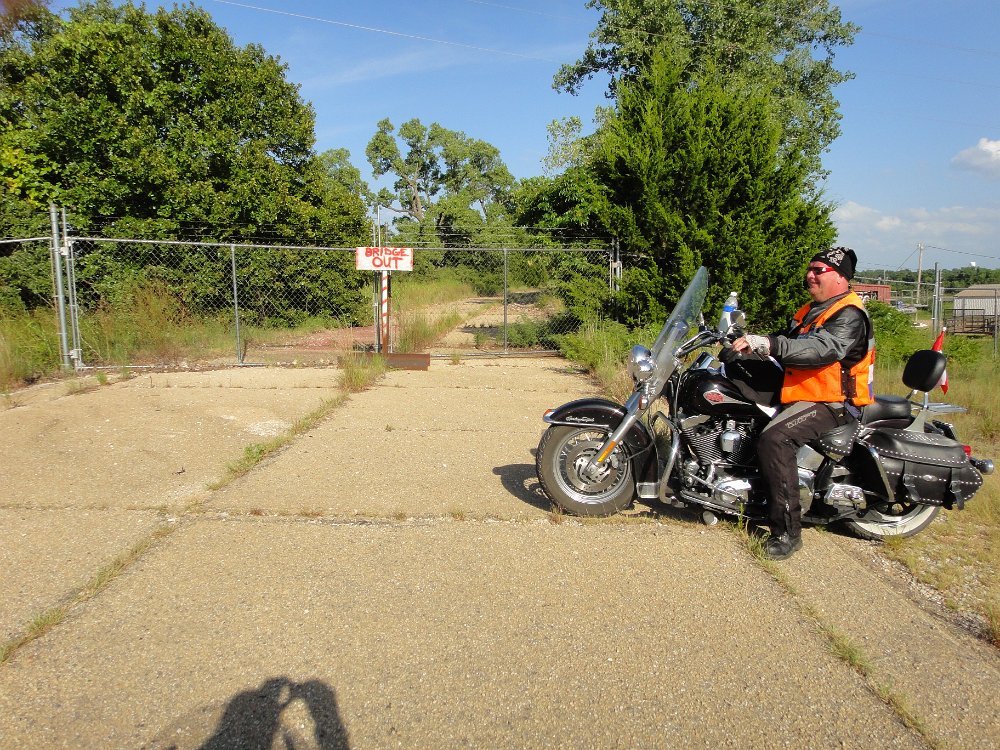
The original pavement, date unknown but it was after Buckley and company took ownership of the property.
The land in question, including that original alignment of Route 66, is still privately owned but property records don't seem to indicate it being broken up among a number of owners. A look back at a cached copy of the original Owners Association website includes the statement, “The deeds, just as with any other warranty deed, can be recorded, and may be re-sold by the owners should they so desire.”
Does that mean that the owners had to separately record their deed with Oklahoma County in order to be valid? If so, did anyone that received a deed actually take that next step?
These are good questions...but not ones we have the resources to answer. As far as we could find, there was never any formal contact between this organization and the Oklahoma Route 66 Association. A real estate attorney would probably have to be engaged to untangle it all at this juncture with in-depth title examinations.
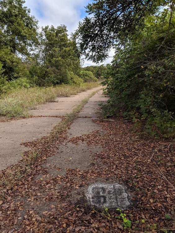
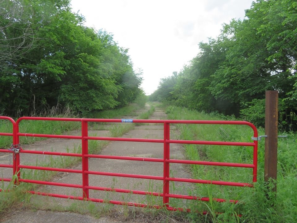
The strip of original Route 66 pavement north of Luther remains intact and is on private property with NO TRESSPASSING. Most people that drive by don't even notice the old road tucked away behind the tall grass. An old bridge support near a Conoco station, which once carried US Highway 66 across the Deep Fork River, is the most obvious remnant of that alignment.
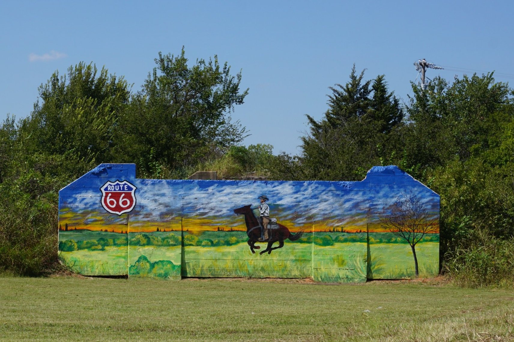
Evidence of the old alignment in 2015. The mural has changed since then.
If you or anyone else knows anything more about this preservation effort, please let us know. We'd love to incorporate more of this story, and this section of the road, into the Centennial celebrations in 2026.