National Register of Historic Places
Did you know that Oklahoma’s stretch of Historic Route 66 has more than 200 properties listed on the National Register of Historic Places? Check out the below locations next time you’re driving the old road and imagine what life was like in the era they were built.
Counties are listed east/west and cities within each county are in alphabetical order. Register listings in larger cities are limited to those along the Route 66 corridor.
Ottawa County
Afton

Cities Service Station

Horse Creek Bridge
Junction of 1st Street & Central Avenue
GONE
Photo courtesy of the National Park Service
Junction of State Highway 69 & Horse Creek
GONE
Miami (and vicinity)

Coleman Theater
103 N Main Street

Commerce Building - Hancock Building
103 E Central
Photo courtesy of AbeEzekowitz/Wikipedia

Dobson Family House
106 A Street SW
Photo courtesy of Jordan Boyd/Wikipedia


Marathon Oil Company Service Station
331 S Main Street

Sidewalk Highway/Ribbon Road
Nine-Foot-Wide section of Route 66 roadbed southwest of Miami
1001 Rockdale Street
Photo courtesy of AbeEzekowitz/Wikipedia

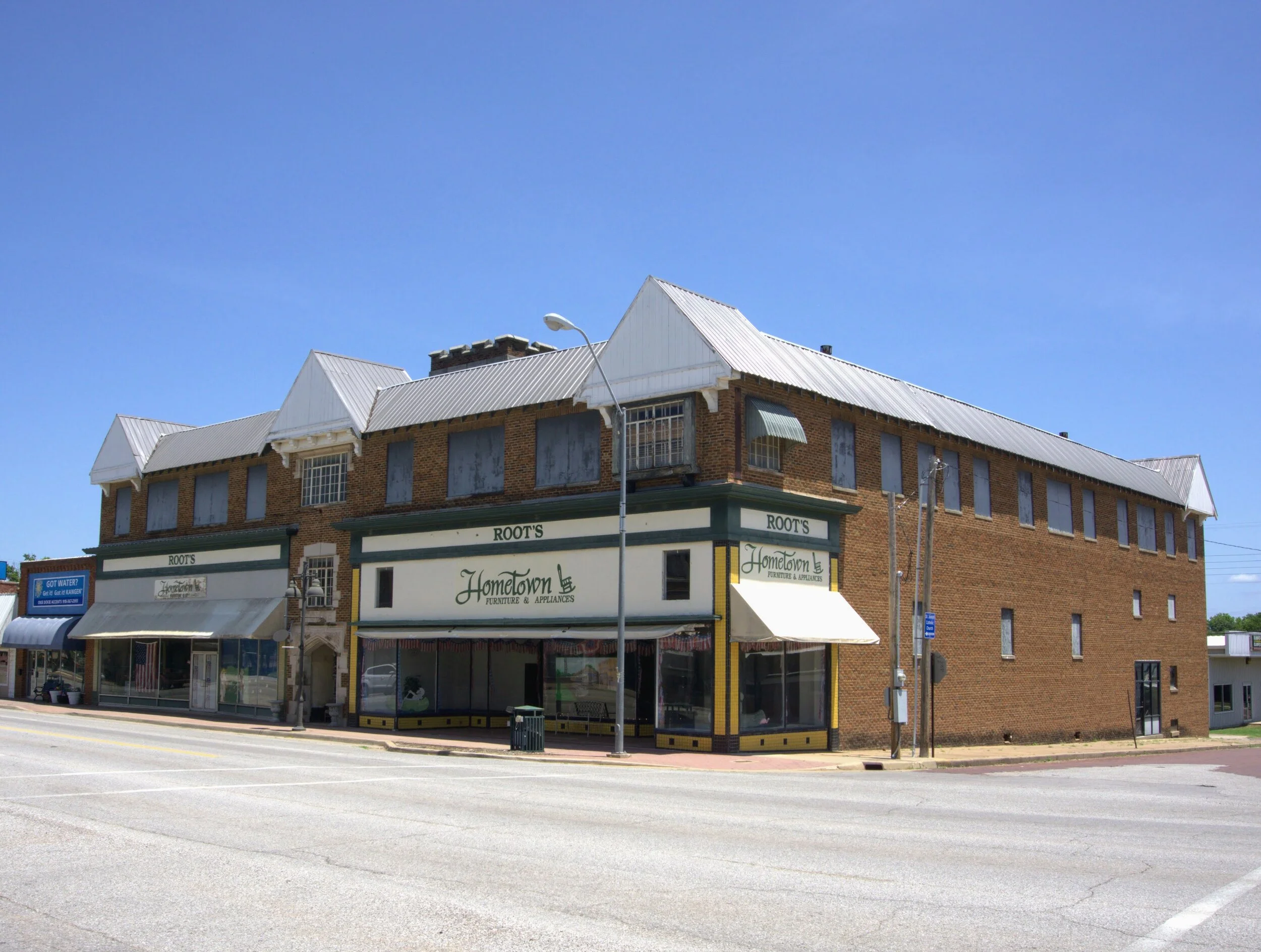
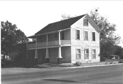
George L Coleman, Sr. House
Roughly the 100 block of N. Main, the 0 block of S. Main, the 0 block of Central Avenue and the 0 block of SE A Street

Miami Downtown Historic District
Hudson Service Station
218 S Main St.
Photo courtesy of KTUL Tulsa

Ottawa County Courthouse
102 E Central
GONE

Peoria Tribal Cemetery
East of Miami
Photo courtesy of AbeEzekowitz/Wikipedia

Riviera Courts/Holidays Motel
Southeast of Miami
Photo courtesy of AbeEzekowitz/Wikipedia

Modoc Mission Church and Cemetery
15050 S Highway 69
GONE
Photo courtesy of the National Park Service

Narcissa D-X Gas Station
East of Miami
Photo courtesy of AbeEzekowitz/Wikipedia

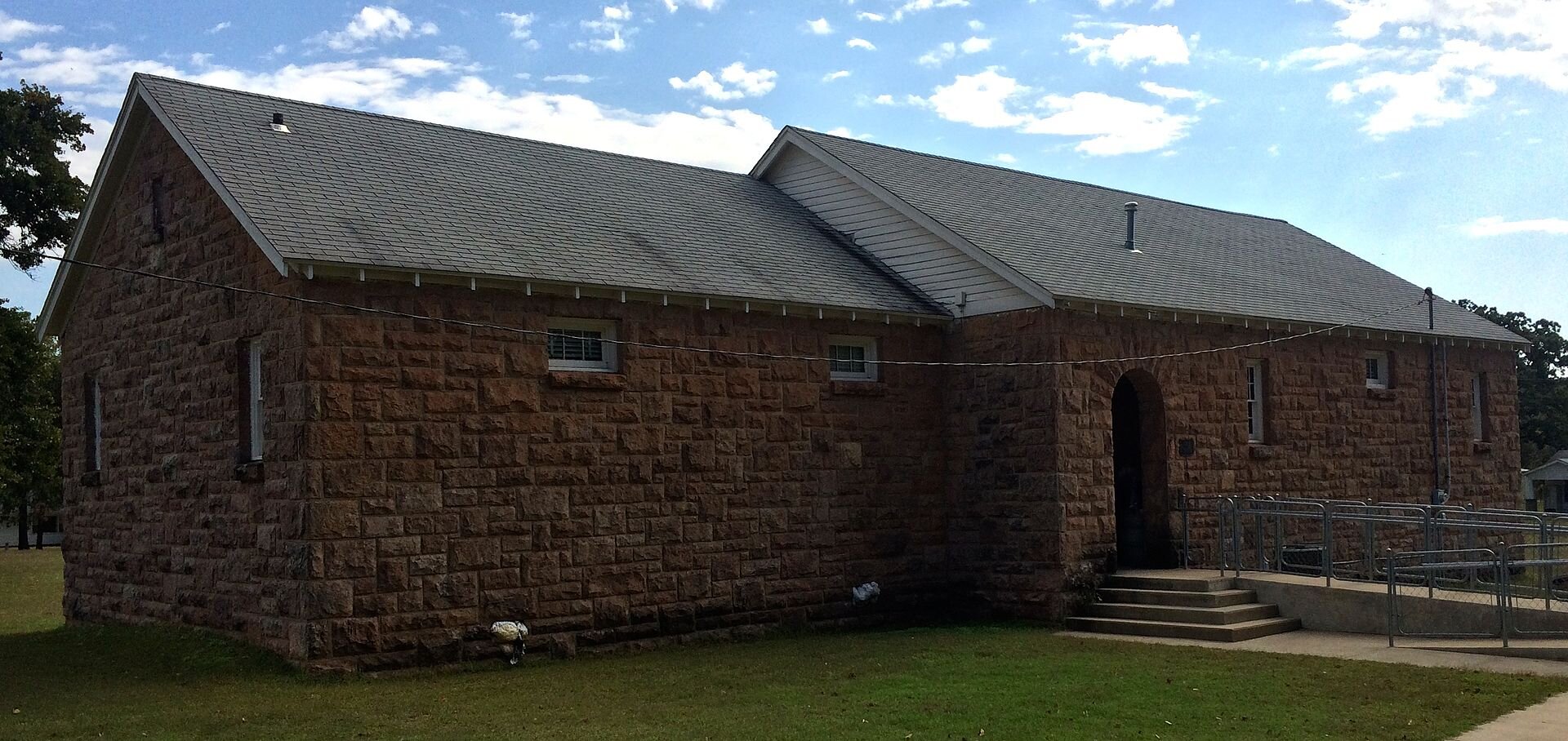
Peoria Indian School
One mile west of Main Street, Highway 69A
County Road 137, 1.5 miles north of State Highway 10
Photo courtesy of AbeEzekowitz/Wikipedia
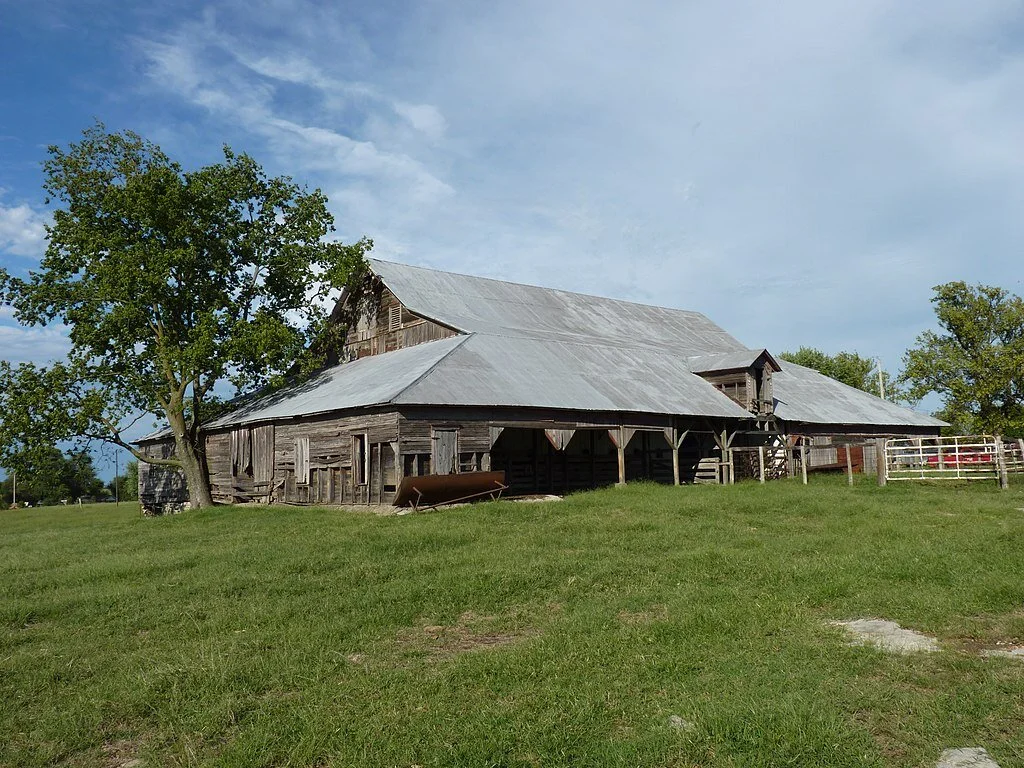
John Patrick McNaughton Barn
Craig County
Vinita (and vicinity)
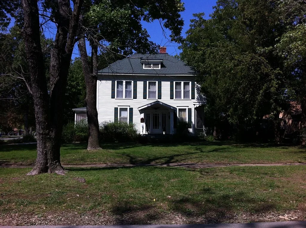
Carselowey House
403 N Gunter
Photo courtesy of John Lovell/Wikipedia

Little Cabin Creek Bridge
US Routes 60/69 over Little Cabin Creek, SE of I-44 Junction

Randall Tire Company
237 S Wilson
Photo courtesy of AbeEzekowitz/Wikipedia
346 S 4th Street
Photo courtesy of AbeEzekowitz/Wikipedia

Attucks School
214 W Canadian Ave
Photo courtesy of AbeEzekowitz/Wikipedia

Craig County Courthouse
314 W Canadian Ave
Photo courtesy of AbeEzekowitz/Wikipedia

First Methodist-Episcopal Church, South
Junction of Canadian & Wilson
Photo courtesy of AbeEzekowitz/Wikipedia

Hotel Vinita
443956 Highway 60
Photo courtesy of AbeEzekowitz/Wikipedia

McDougal Filling Station
240 S Wilson
GONE
Photo courtesy of the National Park Service

Spraker Service Station
Rogers County
Catoosa

Verdigris Club Lodge
27795 S Skelly Drive
Photo courtesy of Onetwotulip/Wikipedia
Chelsea (and vicinity)

Hogue House
1001 S Olive
Photo courtesy of AbeEzekowitz/Wikipedia

Pryor Creek Bridge
1st Street over Pryor Creek, SW of junction with Route 66
NE Corner of 1st Street and Route 66
Photo courtesy of AbeEzekowitz/Wikipedia

Chelsea Motel
Claremore

The Belvidere Mansion
109 N Chickasaw Ave

Eastern University Preparatory School
625 W Will Rogers Blvd
GONE
Photo courtesy of the National Park Service

Claremore Auto Dealership
West Will Rogers Blvd, bounded by Route 66, Muskogee Ave, 4th, and alley between West Will Rogers Blvd & 2nd

Downtown Claremore Historic District
College Hill
Photo courtesy of the National Park Service

Will Rogers Hotel
524 W Will Rogers Blvd
601 E 7th Street
GONE
Photo courtesy of the National Park Service

Mendenhall’s Bath House
College Hill
Photo courtesy of the National Park Service

Maurice Meyer Barracks
Foyil (and vicinity)

Ed Galloway’s Totem Pole Park
State Highway 28A, approx. 4 miles east of OK-66

Foyil Filling Station
12243 S Andy Payne Blvd
Tulsa County

Belmont Apartments
1314 S Denver Ave, West
Photo courtesy of the National Park Service

Boston Avenue Methodist Episcopal Church
1301 S Boston Ave
Also a National Historic Landmark

Casa Loma Building
2626-2648 E 11th St

Circle Theater
10 S Lewis Ave

Cities Service Station #8
1648 Southwest Blvd

Daniel Webster High School
1919 W 40th St
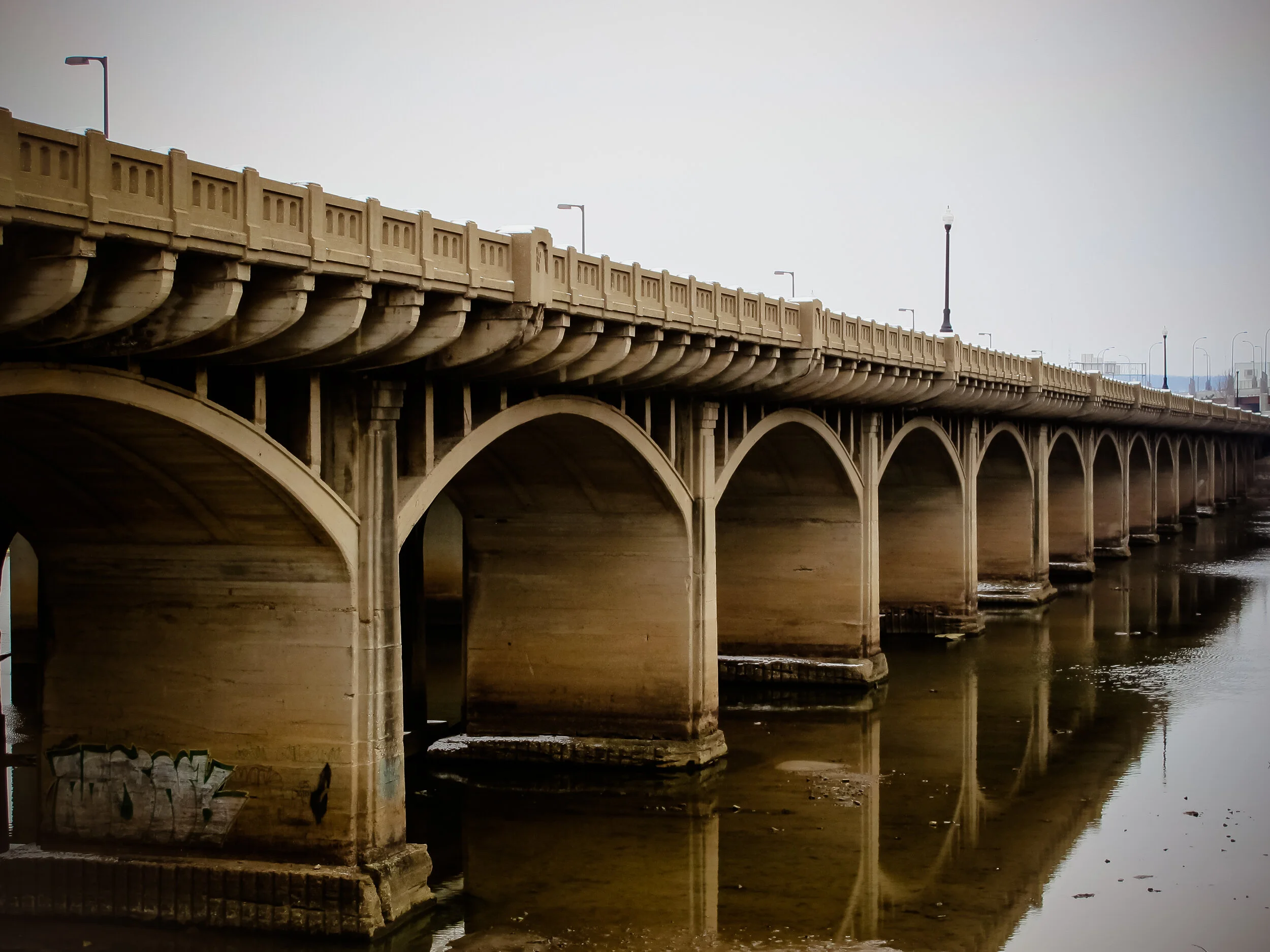
Eleventh Street Arkansas River Bridge
Paralleling Southwest Blvd over the Arkansas River
Roughly between S Kenosha Ave & S Detroit Ave, Frisco Railroad Tracks, and E 8th

Blue Dome Historic District

Hooper Brothers Coffee Company Building

Sinclair Service Station
3501 E 11th St

Tulsa Monument Company
1735 E 11th Street, South

Vickery Phillips 66 Station
602 S Elgin Ave
731-733 E Admiral Blvd
2224 E Admiral Blvd
Photo courtesy of the National Park Service

Phillips 66 Station #473
1309-1314 S Jackson Ave
Photo courtesy of the National Park Service

Sally Ann Apartments
3660 Southwest Blvd
GONE
Photo courtesy of the Marian Clark archives

66 Motel
Roughly bounded by Norfolk, Peoria, 11th, and 13th Streets
Photo courtesy of David Stapleton/Wikipedia

Tracy Park Historic District
Roughly bounded by E 2nd Street, S. Fulton Avenue, the former St. Louis-San Francisco railroad tracks, E. 11th Street and S. Yale Avenue.
Photo courtesy of the National Park Service

White City Historic District
Creek County
Bristow (and vicinity)

Bristow Presbyterian Church

Bristow Tire Shop
115 W 4th Street

Creek Masonic Lodge #226
417 N Main Street
House Building
301-305 N Main Street

Little Deep Fork Creek Bridge
Route 66
Photo courtesy of the National Park Service
210 E 9th Street
Photo courtesy of Melodibit/Wikipedia

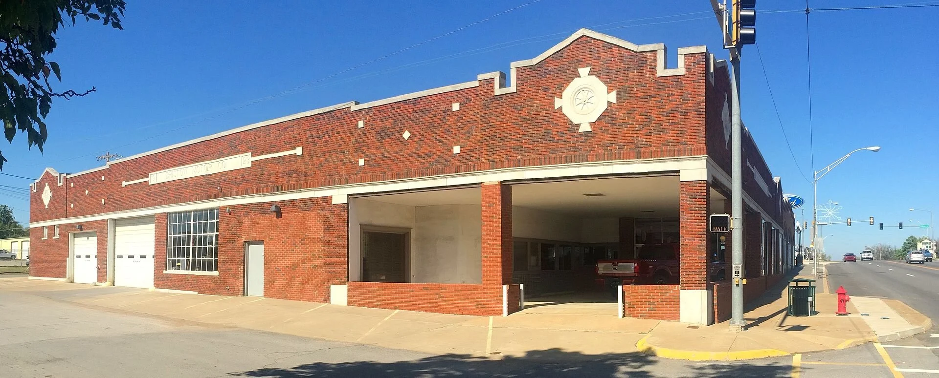
Beard Motor Company
321 N Main Street
Photo courtesy of Melodibit/Wikipedia

Bristow Firestone Service Station
Bristow Motor Company Building
500 N Main Street
Photo courtesy of Melodibit/Wikipedia
6th and Elm Streets
Photo courtesy of Melodibit/Wikipedia
West 7th, West 5th, & Country Club Drive
Photo courtesy of the National Park Service

Klingensmith Park Amphitheater

Tank Farm Loop
Route 66 roadbed
Photo courtesy of Melodibit/Wikipedia

John Frank House
1300 Luker Lane
Photo courtesy of Jeff M Jones/Wikipedia

Sapulpa Downtown Historic District
Roughly bounded by Hobson Avenue, Elm Street, Lee Avenue, and Main Street
201 W 4th Street
Photo courtesy of Melodibit/Wikipedia

Texaco Service Station
Depew

Depew Route 66 Segment
Milfay Road east
Photo courtesy of Melodibit/Wikipedia
Sapulpa (and vicinity)

Bridge #18 at Rock Creek
Junction of State Highway 66 & Rock Creek
14-20 E Dewey Avenue
Photo courtesy of Melodibit/Wikipedia

Berryhill Building
222 E Dewey Avenue
Photo courtesy of Melodibit/Wikipedia

Creek County Courthouse
708 S Main Street
GONE
Photo courtesy of the National Park Service

McClung House
West of the Rock Creek Bridge
Photo courtesy of Melodibit/Wikipedia

West Sapulpa Route 66 Roadbed
Lincoln County
Chandler (and vicinity)

Boston Store
917 Manvel Avenue
Photo courtesy of Melodibit/Wikipedia

Chandler Armory
Junction of Mickey Clarkson Avenue & 1st Street

Chandler Baseball Camp
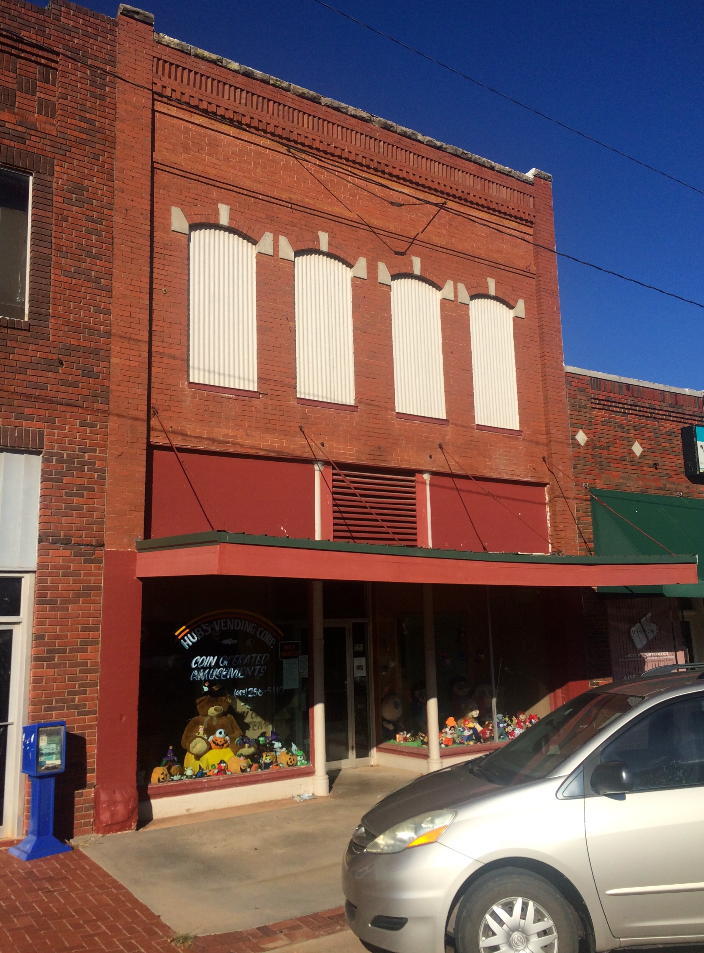
Chandler Bookstore
713 Manvel Avenue

Conklin House
206 W 8th Street
2000 W Park Road
Photo courtesy of Melodibit/Wikipedia
515 Steele Avenue
Photo courtesy of Taylor Baker/Wikipedia

Chandler High School
1021 Manvel Avenue
Photo courtesy of Melodibit/Wikipedia

Clapp-Cunningham Building
Flynt Building
720 Manvel Avenue
Photo courtesy of Melodibit/Wikipedia

National Guard Statistical Building

Oleson-Crane Building
721 Manvel Avenue
Photo courtesy of Melodibit/Wikipedia

Phillips 66 Station #1423
701 Manvel Avnue
722 Manvel Avenue
Photo courtesy of Melodibit/Wikipedia

Crane Motor Company Building
8th Street & Blaine
Photo courtesy of Taylor Baker/Wikipedia

First Presbyterian Church of Chandler
503 Manvel Avenue
Photo courtesy of Taylor Baker/Wikipedia

Johnson House
717-719 Manvel Avenue
Photo courtesy of Melodibit/Wikipedia

Mascho Building & Public Privy (Murphy Building)
4 miles south and 2.25 miles west of the junction of State Hwy 18 and Route 66
Photo courtesy of kennethaw88/Wikipedia

Midlothian School
One Block west of 6th Street on Park Road
Photo courtesy of Melodibit/Wikipedia

St. Cloud Hotel
1216 Manvel Avenue

St. Stephen’s Episcopal Church
812 Blaine Avenue
Photo courtesy of Melodibit/Wikipedia

Wolcott Building
725 Manvel Avenue
Photo courtesy of kennethaw88/Wikipedia
5 miles south & 2 miles west of junction of State Highways 66 & 18
Photo courtesy of Melodibit/Wikipedia

Spring Dell School
2 miles northwest of Chandler off State Highway 66
Photo courtesy of the National Park Service

Marshall William M. Tilghman Homestead
Davenport
1-600 Broadway Street
Photo courtesy of Melodibit/Wikipedia
Davenport Broadway Avenue Brick Street

Stroud (and vicinity)
404 N 4th Ave
Photo courtesy of Melodibit/Wikipedia

Bon Ton House
204 W 6th Street
Photo courtesy of Melodibit/Wikipedia

Joseph Carpenter House
Main & 2nd Avenue
Gone
Photo courtesy of the National Park Service
Graham Hotel
622 N 4th Avenue
Photo courtesy of Melodibit/Wikipedia

Hadley House

Walter Hadley House
424 W 7th Street
Photo courtesy of Melodibit/Wikipedia

Hotel Lincoln
323 Main Street
Photo courtesy of Melodibit/Wikipedia

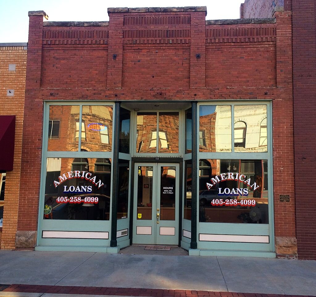
William Alfred Mensch Building
218 W Main Street
Photo courtesy of Melodibit/Wikipedia

Rock Cafe
114 W Main Street

Southwestern Bell Telephone Building
308 W 5th Street
Photo courtesy of Melodibit/Wikipedia

George Hughes House
6 miles south of Stroud
GONE
Photo courtesy of the National Park Service

Moses Keokuk House
1 mile east of Junction I-44 & State Highway 99
Photo courtesy of Melodibit/Wikipedia

Old Stroud School
Junction of N3540 Rd. and E0890 Rd. west to the junction of E0890 Rd
Photo courtesy of Melodibit/Wikipedia

Ozark Trail Section of Route 66
301 W 7th Street
Photo courtesy of Melodibit/Wikipedia

Stroud Trading Company Building
Main & 2nd Avenue
110 E 2nd Avenue
Photo courtesy of Melodibit/Wikipedia

James W Stroud House
Warwick

Seaba’s Filling Station
8 miles west of Chandler on State Highway 66
Approx. 1 mile east & 3 mile north of junction of US 177 & State
Highway 66
Photo courtesy of Melodibit/Wikipedia
Warwick School
Wellston

Captain Creek Bridge
West of downtown Wellston on State Highway 66b
Oklahoma County
Arcadia (and vicinity)

Arcadia Round Barn
State Highway 66

Edward Richardson Building
101 Main Street

Tuton’s Drugstore
1st Street & Main
Photo courtesy of Melodibit/Wikipedia

Citizen’s Bank of Edmond
102 S Broadway
Photo courtesy of JDessary/Wikipedia
Extends south/southeast from junction of State Highway 66 & Hiwassee Road
Photo courtesy of Melodibit/Wikipedia

Arcadia Route 66 Roadbed
Edmond
Junction of 5th Street & Littler, SW corner
Photo courtesy of JDessary/Wikipedia

American Legion Hut
21751 N McArthur Boulevard
Photo courtesy of Melodibit/Wikipedia

Cartmill Farm House
431 S Boulevard
Photo courtesy of JDessary/Wikipedia

Edmond Armory
101-109 W 2nd Street
Photo courtesy of OKJaguar/Wikipedia

Edmond Ice Company
Covel Road between Douglas and Post Road
Photo courtesy of Melodibit/Wikipedia

Gower Cemetery
5801 NW 178th Street
Photo courtesy of Rocketchess/Wikipedia

Hopewell Baptist Church
525 N Jackson
Photo courtesy of JDessary/Wikipedia

Kivlehen House
400 E Hurd, University of Central Oklahoma campus
Photo courtesy of JDessary/Wikipedia

Old North Tower
100 N University, University of Central Oklahoma campus
Photo courtesy of JDessary/Wikipedia

The “Y” Chapel of Song
Luther (and vicinity)

Engles’ Dry Goods Store
114 S Main
Photo courtesy of Melodibit/Wikipedia
Junction of State Highway 66 & Pottawatomie Road, SW corner

Threatt Filling Station
Oklahoma City
5801 N Martin Luther King Boulevard
Photo courtesy of Melodibit/Wikipedia

Bourne Dairy

Citizens State Bank
1112 NW 23rd Street

Electric Transformer House

Lake Overholser Bridge
N Overholser Drive, 1/2 mile west of N Council Road

Milk Bottle Grocery
2426 N. Classen Boulevard
Irregular pattern roughly bounded by NE 13th Street, NE 23rd Street, Lincoln Boulevard & Kelley Avenue
Photo courtesy of Riggleman/Wikipedia

Capitol-Lincoln Terrace Historic District
2412 N Olie Avenue
Photo courtesy of Pigdogx/Wikipedia
4345-4545 N Lincoln Boulevard, 416 NE 46th
Photo courtesy of the National Park Service

Lincoln Plaza Historic District
Roughly bounded by NW 16th and 23rd Streets and Western and Walker
Avenues
Photo courtesy of Matthew Rutledge/Wikipedia

Mesta Park
2501 N Blackwelder Avenue
Photo courtesy of Matthew Rutledge/Wikipedia
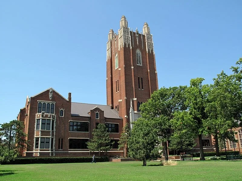
Oklahoma City University
6300 N Western Avenue
Photo courtesy of the National Park Service

Oklahoma County Home for Girls
Oklahoma Historical Society Building

2100 Lincoln Boulevard
Photo courtesy of Daniel Mayer/Wikipedia
Oklahoma National Guard Armory

200 NE 23rd
Photo courtesy of kennethaw88/Wikipedia

Oklahoma State Capitol
2300 N Lincoln Boulevard

Paseo Neighborhood Historic District

Donald Pollock House

Taft Junior High School
2901 NW 23rd Street
Photo courtesy of H.L.I.T./Wikipedia

Will Rogers Park Gardens and Arboretum
3400-3500 NW 36th Street
Photo courtesy of Cburga1964/Wikipedia
Roughly by NW 30th Street, N. Western Avenue, 24th Street and N. Walker Avenue
Photo courtesy of Curtis Burga/Wikipedia
2400 NW 59th Street
Photo courtesy of Melodibit/Wikipedia
Roughly bounded by NW 30th and NW 25th Streets, N Pennsylvania Avenue, and Youngs Boulevard
Photo courtesy of OKJaguar/Wikipedia

Shepherd Historic District
1401 NW 23rd
Photo courtesy of MisterBadmoon/Wikipedia

Smith & Kernke Funeral Directors
State Highway Department Testing Laboratory

2311 North Central Avenue
Photo courtesy of OKJaguar/Wikipedia
5505 N Brookline Avenue
Photo courtesy of Pigdogx/Wikipedia

Tiffany House
Blaine County
Geary
102 E Main
Gillespie Building
Canadian County
El Reno (and vicinity)

Canadian County Jail and Stable
300 S Evans
Photo courtesy of MisterBadmoon/Wikipedia

El Reno Hotel
300 S Choctaw
Photo courtesy of Crimsonedge34/Wikipedia

El Reno Municipal Swimming Pool Bath House

Fort Reno
3 miles west & two miles north of El Reno

William I. and Magdalen M. Goff House
220 S Choctaw
Photo courtesy of MisterBadmoon/Wikipedia

Avant’s Cities Service Station
215 E Wade
Photo courtesy of MisterBadmoon/Wikipedia

Carnegie Library
6 miles northwest of El Reno
Photo courtesy of Crimsonedge34/Wikipedia

Darlington Agency Site
405 S Choctaw
Photo courtesy of MisterBadmoon/Wikipedia

El Reno High School
715 S Morrison
Photo courtesy of Crimsonedge34/Wikipedia
301 S Choctaw
Photo courtesy of MisterBadmoon/Wikipedia

Mennoville Mennonite Church
301 S Choctaw
Photo courtesy of MisterBadmoon/Wikipedia

Jackson Conoco Service Station
605 S Hoff
Photo courtesy of MisterBadmoon/Wikipedia

Henry Lassen House
North of El Reno on US Route 81
Photo courtesy of MisterBadmoon/Wikipedia
Grand Avenue & London Street, NW corner
Photo courtesy of MisterBadmoon/Wikipedia

Red Cross Canteen
400 W Wade
Photo courtesy of MisterBadmoon/Wikipedia

Rock Island Depot
319 S Grand Avenue
Photo courtesy of Crimsonedge34/Wikipedia

Southern Hotel
Yukon (and vicinity)

West Point Christian Church
Southwest of Yukon
Photo courtesy of Melodibit/Wikipedia
South of Yukon
Photo courtesy of Kristi Ellis/Wikipedia

Czech Hall
425 W Main
Photo courtesy of Kristi Ellis/Wikipedia

Mulvey Mercantile
512 Elm Street
Photo courtesy of Kristi Ellis/Wikipedia

Yukon Public Library
Blaine County
Geary (and vicinity)

Jesse Chisholm Grave Site
NE of Geary near North Canadian River
Photo courtesy of blogoklahoma.us

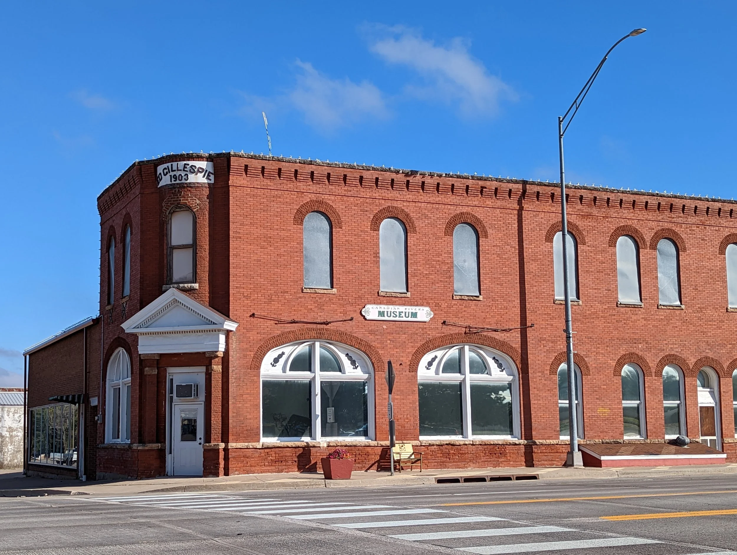
Gillespie Building
102 E Main
Photo courtesy of Pigdogxl/Wikipedia
Route 66 and US 281
Photo courtesy of the National Park Service

Bridgeport Hill Service Station
Junction of Main, Canadian, & Northeast Boulevard
Photo courtesy of Pigdogxl/Wikipedia

Public Water Trough
Caddo County
Hydro & Bridgeport (and vicinity)

Bridgeport Bridge
North US-281 over the South Canadian River

Bridgeport Hill - Hydro Route 66 Segment

Provine Service Station
1/2 mile east of junction of I-40 & State Highway 58
State Highway 66 from Hydro east to US-281 Spur
Custer County
Clinton (and vicinity)

Crawford House
600 N 13th
Photo courtesy of Jeffrey Beall/Wikipedia

Y Service Station and Cafe
1733 Neptune Drive
723 S 13th
Photo courtesy of Jeffrey Beall/Wikipedia

Clinton Armory
Junction of 10th Street and Bess Rogers Drive
Photo courtesy of Jeffrey Beall/Wikipedia

McLain Rogers Park
Weatherford

Owl Blacksmith Shop
208 W Rainey Street
GONE
State Street, Southwestern Oklahoma State University
Photo courtesy of Jeffrey Beall/Wikipedia

Old Science Building
123 W Rainey Street
Photo courtesy of Jeffrey Beall/Wikipedia

Weatherford Armory
Washita County
Canute

Canute Service Station
Junction of Main Street & US-66, SW corner
Beckham County
Elk City

Casa Grande Hotel
103 E 3rd Street
Photo courtesy of Crimsonedge34/Wikipedia

Hedlund Motor Company Building

Whited Grist Mill
306 E 7th Street
Photo courtesy of Crimsonedge34/Wikipedia
206 S Main
Photo courtesy of Crimsonedge34/Wikipedia
721 W Broadway
Photo courtesy of Crimsonedge34/Wikipedia

Storm House
Erick (and vicinity)

First National Bank
101 S Main
Photo courtesy of Crimsonedge34/Wikipedia
623 Roger Miller Boulevard
Photo courtesy of Crimsonedge34/Wikipedia

West Winds Motel
Sayre

Beckham County Courthouse
Courthouse Square

J.W. Danner House
408 N 4th Street
Photo courtesy of Crimsonedge34/Wikipedia

Sayre Downtown Historic District
Main & 4th Street
Photo courtesy of Crimsonedge34/Wikipedia
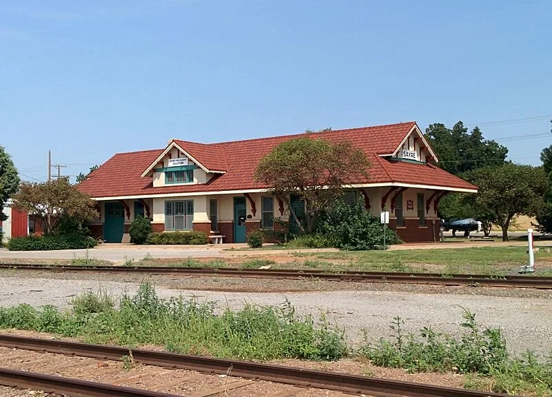
Sayre Rock Island Depot
106 E Poplar
Photo courtesy of Crimsonedge34/Wikipedia
126 W Main
Photo courtesy of Crimsonedge34/Wikipedia

Sayre Champlin Service Station
200 yards south of the junction of E. 1200 Road and N.1870 Road
Photo courtesy of Crimsonedge34/Wikipedia

Sayre City Park
Texola

Magnolia Service Station
Junction of Elm Street & Route 66, SW corner